Tederell Boyer
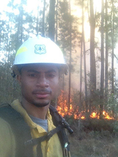
Tederell J. Boyer, also known as “T.J.”, Im with the Wildland Fire Management Research, Development, Application group (WFMRDA) as a Fire application Specislist. I primarily work with the Wildland Fire Decision Support System. Previosuly, I have been the Intelligence Coordinator for the Southern Area Coordination Center since 2017. I worked as a Fire Ecologist between 2011 through 2016 at Land Between the Lakes National Recreation Area.
Originally from Fort Valley, GA, I received my Bachelor of Science degree in Soil Science from Fort Valley State University (FVSU), and a second Bachelor of Science degree in Forest Science from Alabama Agricultural and Mechanical University (AAMU). I obtained firefighting experiences by working and completing a season with the Cherokee Hotshots, Asheville Hotshots, and through multiple fire assignments on engines.
As a dispatcher I have completed multiple assignments in different geographic areas as an Intelligence Support, Expanded Dispatch Recorder, and Expanded Dispatch Support Dispatcher. I enjoy spending time with my wife, son, and daughter.
I can be reached:
Applications managed through WFMRDA:
- Wildland Fire Decision Support System
- Interagency Fuels Treatment Decision Support System
- Fire Modeling Services Framework
Interactive Map of Chattahoochee-Oconee National Forest
- This map was created using Python libraries and OpenStreetMAp data.
Interactive Map of The Annual Sum of Fannin County, Ga Precipitaion
- This map was created to showcase NOAA NCEI climate data workflow for Fannin County, Ga.
- This graph illustrates the annual precipitation (PRCP) in Fannin County, Georgia, from 2008 to present. In relation to severe wildfires that occurred in North Georgia, including Fannin County, in 2016, the graph reveals a notable dip in precipitation during that period.
- The low precipitation levels in 2016 were a major contributing factor to the intensity and spread of the wildfires, demonstrating the critical link between drought conditions and wildfire risk.
- Following 2016, precipitation levels show frequencies of fluctuation, including a notable increase in the years immediately following the fires (2017-2018), which could have implications for post-fire environmental recovery and water quality concerns, such as erosion and debris flows in burn scar areas.
Interactive Map of NDVI Difference for Fannin County, Ga
- This plot shows the change in NDVI spatially before drought/fire disturbance and after drought/fire disturbance.
- This interactive map includes the Chattahoochee–Oconee National Forest.
- Areas shown in pink/purple on the map indicate a decrease in NDVI during the 2016-2018 period compared to 2014-2016. This decline is likely a direct result of the extensive 2016 wildfires in Fannin County which caused widespread vegetation loss and damage.
- Furthermore, areas displayed in green suggest an increase in NDVI, potentially indicating vegetation recovery in less severely burned regions, or areas that were largely unaffected by the fires.
Interactive Map of Vegetation Over Time in Fannin County, Ga
- This plot shows the number of vegetatation over time from 2014 through 2018 to include landscape disturbance before and after major event in 2016.
- This interactive map includes the Chattahoochee–Oconee National Forest.
- The graph shows a sharp decrease in vegetation during 2016, reaching its lowest point around that year, directly correlating with the period of major wildfires in Fannin County, Georgia. These fires consumed significant acreage fueled by severe drought conditions.
- Following the low point in 2016, there is a clear upward trend in vegetatation through late 2016 and into 2017, indicating a period of vegetation recovery after the fires.